Water Security is National Security

Water resources and how they are managed impact almost all aspects of society and the economy, in particular health, food production and security, domestic water supply and sanitation, energy, industry, and the functioning of ecosystems. Under present climate variability, water stress is already high, particularly in many developing countries, and climate change adds even more urgency for action. Without improved water resources management, the progress towards poverty reduction targets, the Millennium Development Goals, and sustainable development in all its economic, social and environ- mental dimensions, will be jeopardized. UN Water.Org

Showing posts with label glaciers. Show all posts

Thursday, November 30, 2017

Tackling water security: Who owns the right to groundwater?

Tariq said that to understand water security there is a need to understand water scarcity. He explained, “The global yardstick for water scarcity is that if you have 1,700 cubic metres per person, per year then you are in a very comfortable water regime.”

He added that the moment this amount reduces, you start getting into water stress situations, water shortages and water scarcity.

“Plant the water, as the best place to store water is underground”
“The surplus water available for Pakistan doesn’t last for more than 30 days.” He elaborated that for the rest of the 335 days, Pakistan is in a semi-drought or drought-like condition.

The PWP CEO said that for an arid country like Pakistan there is a need to have 40% surface water storage. However, he deplored that the country has only 7% storage to counter the problem. He added that this is also reducing due to sedimentation, which leaves a big question mark on the country’s water security. More

Thursday, December 11, 2014

Water woes in Lima: A glimpse of our future?

As UN negotiators meet in Lima to work out a plan for dealing with rising temperatures, Matt McGrath visited a community paying a high price for water supplies threatened by climate change and increasing demand. Is Peru's experience a sign of things to come?

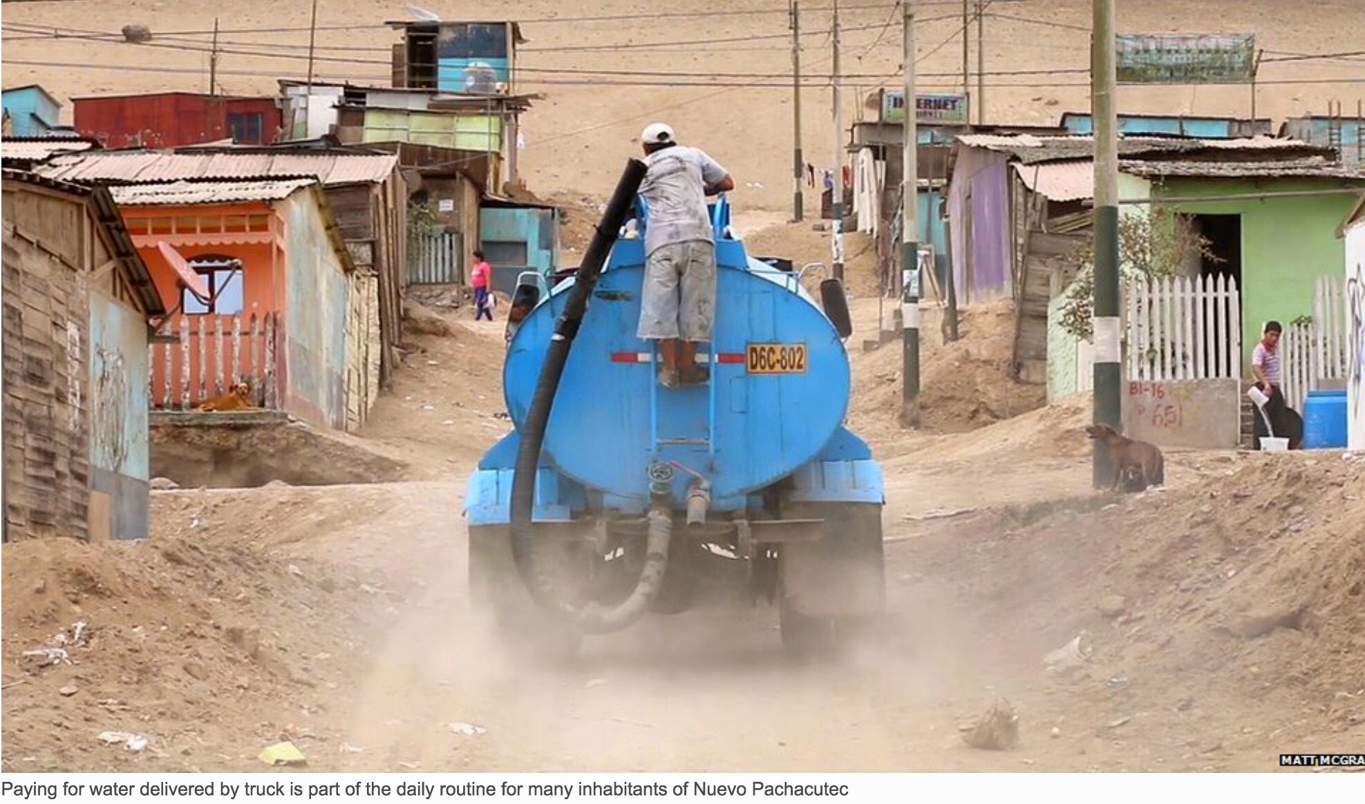
Snarling and screeching, the bouncing water truck speeds backwards down the steep hill, in a cloud of coarse dust.

It halts with a judder and a wild eyed, sweaty man jumps from the cab, grabs a large plastic pipe on the back and starts to fill a series of plastic containers on the ground, with little care.

Dressed in bright pink, a woman looks on nonchalantly.

The man runs up to her and holds out his hand. She drops some coins and away he goes, jumping onto the running board of his vehicle, already snorting its way to the next stop.

This is daily routine for tens of thousands of people who live in this sprawling hillside settlement that looks down on the Pacific Ocean, less than an hour north of Lima, Peru.

Water in Nuevo Pachacutec is not just the vital substance for life, it is a measure of social status and progress.

People first came to these hazy hills in the 1980s, in response to politicians who promised them land in return for votes.

When they first arrived the women said their feet would just sink in the sand. That's all that was here.

The politicians allowed them to take the ground - but most of the 160,000 people here do not have legal title. They are "possessors of the land" but not the owners.

And land is too grand a word. This is really a desert. After Cairo, Lima is said to be the world's second biggest city built in one. Rainfall here amounts to just 50mm of water per year.

A river runs through it

A few kilometres south of Nuevo Pachacutec, a miserable, dirty stream meanders under a motorway.

Bags of rubbish sit alongside the ubiquitous tractor tyres.

This is the Chillon river, the sole water source for around two million people in northern Lima.

The waters of the Chillon are fed by glaciers in the Andes. And this is a source of concern.

"We are worried here in Peru because climate change is already having a huge impact on our access to water," says Armando Mendoza a research officer with Oxfam in the country.

"In the last 40 years, the glacial coverage has retreated by 40% more or less, because of the increase in global warming.

"The predictions are that in the future access to water will become even more difficult and the ones who are most vulnerable to this are the poor."

These longer term water issues with glaciers are not the immediate priority in Nuevo Pachacutec.

As well as the speeding tuktuks, the sandy roads are festooned with signs for car washes, even private schools.

Despite the fact that 80% of the homes are made of wood, incomes and aspirations are rising here.

Access to water is critical in this development, as it is in developing nations all over the world.

With funding from the German government, a green group called Alternativa has helped build networks of white water tanks, connected by underground tubes that bring water directly to the houses.

They have also installed 900 outside water points in this sprawling settlement.

Their efforts to date have brought the vital liquid to 9,000 households.

In this community, water is more than just a key ingredient for life, it is a reflection of harsh social divisions.

The blue barrels

Despite the fact that 80% of the homes are made of wood, incomes and aspirations are rising here.

Access to water is critical in this development, as it is in developing nations all over the world.

With funding from the German government, a green group called Alternativa has helped build networks of white water tanks, connected by underground tubes that bring water directly to the houses.

They have also installed 900 outside water points in this sprawling settlement.

Their efforts to date have brought the vital liquid to 9,000 households.

In this community, water is more than just a key ingredient for life, it is a reflection of harsh social divisions.

Radios and children play loudly on the street where Daniza Cruz Navarro lives.

The homes on this stretch are known as the "casas azules" - the blue houses.

Outside many sit blue plastic barrels, some with lids, some without, that hold the water residents get from the trucks that constantly career about the local roads.

Dogs lap from the open containers. Mosquitoes lay their eggs in the water.

"You can see the effects of the way the water is being stored in the kids' health," says Daniza.

"They often get sick, there is often misuse and mismanagement of the water here."

She has moved on from the blue barrel and is now the owner of a more effective and efficient water tank that she has bought through the efforts of Alternativa.

However, as she still gets water directly from the delivery trucks, she has to pay significantly more than her neighbours.

Daniza says she pays 120 Nuevo Soles (£26; $40) per month for the precious water. This is about 10% of her household income.

Those who are connected to the main water grid pay just 6-12 Soles per month.

These are big sums of money and the differences can be a source of friction between neighbours.

Despite these problems, those who work with the people in Nuevo Pachacutec say progress is being made. It's really a story of local self-empowerment.

"Even if they are not perfect, they have bettered considerably," says engineer Osvaldo Caceres who works with Alternativa.

"This infrastructure is managed by them, for them. The local population know what they want, but they know and understand they have to participate to get it.

Plug and pay


"When we first got here it was all desert - there were no roads, it was pure sand," says Ycella Bonilla a resident of Nuevo Pachacutec.

She stands proudly in the doorway of her recently built bathroom cum laundry room, completed with the help of microfinance.

Ycella calls it her "unit of dignity".

Despite this advance, Ycella and her family are still paying heavily for water. She has a hose and a key that allows her family to plug into a water point. For this she pays 80 Nuevo Soles a month (£18; $27) a month.

Despite the gripes over cost, Ycella recognises that water is the bedrock of development for the community.

"We have roads, we have schools, we have a lot of the basic necessities now, including water."

The struggle for development and the need to have resources like water to empower that development is not just on the minds of those in Nuevo Pachacutec.

An hour down the road in Lima itself, UN climate negotiators are struggling with that same dilemma. How to balance the burgeoning needs of a growing population, with the need to limit those same enriching activities because they threaten the future of the planet.

Osvaldo Caceres says that as in solving the water stresses of Nuevo Pachacutec, the climate battle can be won, by everyone playing their part now. It's no use passing the buck down the generations.

"Every actor in this chain must take responsibility for what they have to do," he says.

"The governments, the authorities, and obviously the people, they all need to act." "There is no other way." More


Friday, November 7, 2014

The Man Who Creates Artificial Glaciers To Meet The Water Needs Of Ladakh

Ladakh’s beautiful mountains might be a paradise for tourists, but ask the locals who have to struggle to meet their basic water needs every year. Chewang Norphel put his engineering skills to a better use and created artificial glaciers to provide water in this cold and dry mountainous region. Know more about his remarkably innovative technology and how it works.

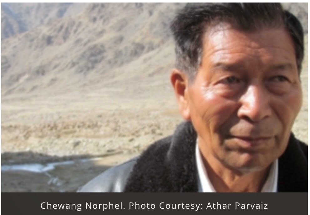
Chewang Norphel, a 79-year old retired civil engineer, has always been a solution provider. The story goes back to 1966 when he was posted in Zanskar, one of the most backward and remote areas in Ladakh, as Sub Divisional Officer. He, along with his team, had to construct school buildings, bridges, canals, roads etc. in that area. The task was very difficult to execute due to lack of skilled labour.

So he started doing the masonry work himself and trained a few villagers to help him. After some years, when he went back to that village, he found out that the villagers he had trained had become perfect mistry and were earning handsome salaries.

Today, he is called the “Ice Man of India” and has created 10 artificial glaciers in Ladakh to help people deal with water scarcity in this cold, mountainous region.

Ladakh, a beautiful location with magnificent scenery around and exquisite beauty, takes everyone’s breath away. But, it is not the same with the people of Ladakh as the cold, dry and infertile land makes their lives harder than we could imagine.

Fortunately, the situation is slowly changing as Ladakh now has artificial glaciers to meet their needs and people have Norphel to thank for his amazing contribution.

Born in 1936, Norphel comes from a farming background and has served in the government service for more than 36 years before he had to take an early retirement due to his bad health. Being at home was not something Norphel enjoyed doing, and at the same time, the poor living conditions in Ladakh constantly troubled him. He thought of putting his engineering skills to a better use.

“Almost all the villages in Ladakh have roads, culverts, bridges, buildings or irrigation systems made by me,”says Norphel. But his biggest contribution came in the form of artificial glaciers.

Being a cold mountain desert, Ladakh sees a low average rainfall of 50 mm annually making people dependent upon glaciers as their primary water source.

80 percent of the population depends on farming, and their main source of irrigation water is the water that comes from the melting of snow and glaciers. Because of global warming, the glaciers are receding quickly and as a result, farmers face a lot of difficulty in getting adequate water. On the other hand, a lot of water gets wasted during the winter months as, due to the severe cold climate, farmers cannot grow any crops in that season.

“So I thought that if we could conserve this water in the form of ice, it can be of help to farmers to some extent during the irrigation period, particularly during the sowing season. The artificial glaciers, being quite close to the villages, melt earlier than the natural glaciers. Also, getting water during the sowing period is the most crucial concern of the farmers because the natural glaciers start melting in the month of June and sowing starts in April and May,” he says.

The idea first came to him when he saw water dripping from a tap which was kept open so as to avoid the water from freezing in winter and bursting the tap. The water gradually froze into the shape of an ice sheet as it came in touch with the ground and made a pool.

It struck him that the water that melts from natural glaciers due to high temperatures in summer goes to waste as it flows into the river. Instead, if this water can be stored in summer and autumn so that it can form a glacier in winter, then this artificial glacier would melt in spring and provide water to the villagers at the right time.

It was now time for action, and he put all his engineering knowledge, field experience and passion to work. He started his first experiment in Phutse village. He made canals to divert the water from the main stream to small catchment areas located four kms away from the village. He also created a shaded area to keep the water frozen in winters.

And, as these glaciers are located at a lower altitude of 13,000 feet as compared to the original glaciers which are located at 18,000 feet, they start melting earlier than the mainstream ones and provide water to the villagers when they need it the most in April.

“The main technique used to create artificial glaciers is to control the velocity of water as much as possible. The region is a hilly area and that is why the gradient of streams is very steep. As a result, in the main streams the water usually does not freeze. So what we have done is we have diverted the water to a shadow area by constructing a diversion channel with a mild grade. When it reaches the site, the water is released downward of the hill, distributing it in a small quantity so that the velocity can be minimized, and side by side we have constructed ice retaining walls in series to store the frozen water. This is the entire methodology of the artificial glacier,” he explains.

Retaining walls for artificial glacier

His first project cost him Rs.90,000. The width of the glacier ranges generally from 50 to 200 feet and the depth from 2 to 7 feet. This low cost model used only locally sourced material and help from the local community. Norphel has successfully built 10 glaciers so far. The smallest one is 500 feet long in Umla and the largest is 2 km long in Phutse.

His efforts have increased the agricultural production, thereby increasing the income of the locals. This has also reduced the migration to cities. His simple technique has brought water closer to the villages, and most importantly, made it available when the villagers need it the most.

In the future, he wants to continue making the glaciers and plans to build in other areas like Lahol, Spiti, Zangskar, etc. The only thing that comes as a challenge is lack of adequate funds.

“As you sow, so you reap. There is no doubt that if one has strong determination and dedication, there is nothing impossible in the world. That is what I believe,” Norphel says.

His simple idea has received acclaim across the globe and he has proved that if man is the one responsible for disturbing nature, he also has the capacity to save it. You just need the right intention to do so. More


Thursday, May 22, 2014

Challenge in Sao Paulo: Overcoming Water Scarcity in South America’s Largest City

Last March, one of Brazil’s most important newspapers, O Estado de S. Paulo, published a version of the article below, which summarizes the Conservancy’s efforts to help secure Sao Paulo’s water supply. It is translated and reprinted here with permission.

By João Campari and Samuel Barrêto, The Nature Conservancy

The inhabitants of Sao Paulo have been dealing with discouraging images of cracked riverbeds where they used to see flowing water, making this temperate part of Brazil look more like the country’s semi-arid region. Unfortunately, these stark images show the worsening struggles of the Cantareira system, one of the greatest water supply systems in the world.

Right now, the Cantareira’s reservoirs — responsible for providing water for more than 12 million inhabitants of the Sao Paulo Metropolitan Region (RMSP) and Campinas — are operating at less than 15% capacity*, the lowest level recorded since the Cantareira’s creation in the early 1970s.

The images, the symbol of the current crisis, show that water doesn’t really come from the taps in our houses. It comes from nature, and in Sao Paulo much of that nature is the Atlantic Forest. While water rationing gets peoples’ attention and is one of the necessary responses to water scarcity, rationing alone is not enough to solve the long-term problem of securing lasting access to fresh water.

We must look beyond the tap and work to take care of our water supplies at their sources. We need a systemic response for the management of watersheds to restore the sources of our water that have been degraded, polluted and deforested. Forests are very important for healthy fresh water supplies. Unfortunately, the Cantareira system alone has lost 70% of its original forest cover, aggravating the sedimentation of rivers and dams, and decreasing their ability to supply water.The degradation of native vegetation also worsens the effects of erosion and drought.

The interaction of all these factors — deforestation, sedimentation, erosion and drought — leads to a situation of extreme risk and represents an environmental, social and economic threat not just to Sao Paulo, but to the entire country of Brazil. The Sao Paulo Metropolitan Region and Campinas together are responsible for more then 22% of the country’s GDP. Therefore, it is a priority to create a strong and strategic response to the increasing and urgent problems of water quantity, quality, access and supply for urban centers.

Protecting Water Supplies at their Sources

We must go beyond conventional interventions, such as engineering works — more dams or aqueducts are not the answer. Wider, systemic responses are necessary, and the responsibility to act is not limited to the government. We all need water and it is the shared responsibility of businesses, communities and civil society as a whole to search for solutions together. The government’s role is to foster and implement multiple solutions that reach multiple stakeholders at once.

The Conservancy’s work shows that one of the highest priorities for securing Sao Paulo’s water supplies is strengthening the Cantareira system’s “green infrastructure” by restoring the degraded forests of the Atlantic Forest, as well as conserving existing forest remnants. Such initiatives ensure the health of a watershed. This type of solution, when well managed, minimizes the risk of extreme events and reduces the vulnerability of populations to floods and prolonged droughts. Healthy forests also store water and reduce erosion and provide environmental services of water regulation and security to the population.

New York City illustrates this equation quite clearly. Decades ago, the city’s administration compared the costs of both natural and built infrastructure for protecting and providing water. Preserving the forests that were source of the city’s drinking water cost US $1 to 1.5 billion over 10 years. That amount was seven times lessthan the estimated US $6 to 8 billion needed to build a traditional, engineered water treatment and distribution network. (That amount doesn’t include the additional and ongoing operational and maintenance costs of $300 to $500 million a year that would have been necessary.) Obviously, nature was the better buy for the people of New York.

It is something for Sao Paulo to consider. A recent study by the Conservancy showed that restoring about 35,000 acres of deforested areas and preventing erosion on 5000 acres within the basins of the Piracicaba, Capivari, Jundiaí and Alto Tietê rivers would decrease the level of sediments that clog the rivers by 50%. Reducing erosion would increase the capacity of water reservoirs and simultaneously decrease the cost of treatment for the removal of sediments.

What the Conservancy is doing in Sao Paulo

To help accomplish restoration goals in the lands around Sao Paulo’s Cantareira system, the Conservancy-led Water Producers Project provides payments to farmers and ranchers who conserve forests on properties that are part of the watershed that feeds the Cantareira reservoirs. This payment-for-environmental-services program recognizes and compensates landowners for the water-producing value their lands provide.

The Conservancy also leads the Water for Sao Paulo Movement. This initiative fosters conversation and working relationships between different stakeholders and focuses on the importance of both water conservation and nature-based solutions for securing the water supply of the region. Because healthy forests are so important for healthy rivers and water supplies, Water for Sao Paulo seeks to restore degraded forests near the urban area.

Finally, Sao Paulo must strengthen the existing Watersheds Committees. Created by the Brazilian Legislature, Watersheds Committees discuss and make decisions about the use of water from specific river basins and are some of the most important collaborations for achieving a balance between water supply and demand.Committees include representatives of local governments, water supply companies and civil society, who are responsible for tasks such as approving water management plans, defining actions for conservation of biodiversity and mediating conflicts about the use of water resources. There are more than 200 of these groups in Brazil.

The current crisis in the Cantareira system is both a challenge and an opportunity to learn from the past and make better decisions for the future. If we have the discernment to act in a systemic way and the political and institutional capacity for change, we will be able to reduce the risks of a permanent cycle of water shortage. In addition to this, we have the opportunity to show how healthy watersheds contribute to water security, which is indispensable for Sao Paulo’s social and economic stability into the future.

To learn more about how the Conservancy is helping to secure Brazil’s water supplies, please visit Where Does Your Water Come From?

*Since this article was published in March, the need for concerted action in Sao Paulo has become even more urgent. The level of water in the Cantareira system has now dropped – to about 8% of its overall capacity. As an emergency stopgap to provide water to the city, the government of Sao Paulo spent US$36 million on emergency constructions to allow access to water stored below the level of the pumps. Known to water managers as “dead volume,” this water was never intended to be part of the water supply, and the reservoirs are now, essentially, operating at a deficit. More


Sunday, March 23, 2014

How NASA Can Save Us Billions of Gallons of Water

Here’s something to add to your doomsday list of natural resources that people need to survive but are threatened by climate change: snow.

It’s a key source of freshwater for more than 1 billion people across the globe, slaking thirst, irrigating croplands, and driving turbines that generate electricity. Conveniently, in much of the world, snow also acts as a natural reservoir, storing water during wet seasons, then rationing it out slowly during drier summer months. But today, growing populations, warming temperatures, and changing weather patterns are straining that supply like never before. “June is the new July,” says Auden Schendler, vice president of sustainability at Aspen Skiing Company in Colorado. “Snowmelt comes earlier than it used to, and it all happens in one big flood.”

Which means that knowing exactly how much snow is in the highlands—and when it’s coming down to lower elevations to feed rivers, aqueducts, and irrigation channels—is ever more important. But how do you measure something that’s spread over thousands of miles of steep, rugged, alpine terrain?

Tom Painter, a research scientist at NASA’s Jet Propulsion Laboratory, has an answer: by measuring snow from thousands of feet in the air. Using sophisticated, aircraft-borne sensors that gauge snow’s depth and the amount of light it reflects, Painter and his team are assembling the most accurate measurement ever made of just how much water the mountains hold.

This is welcome news in California, where the water content of accumulated snow is at historically low levels. Runoff from the Sierra Nevada mountains provides about a third of the entire state’s water, and up to 80 percent in some areas, supplying tens of millions of people and almost 1 million acres of farmland.

Painter can’t make it snow, but he can provide more and better data to water managers, who need to plan how to most efficiently fill their reservoirs; farmers deciding which crops to plant and when; and cities trying to figure out if they’ll have enough water to supply their residents—or will need to start rationing. “The demand for knowledge about water resources is at an all-time high,” says Painter, a gregarious, athletically built 46-year-old.

For decades, state water officials have estimated the snowpack’s water content by a straightforward method that will appeal to steampunk aficionados: They clamber into the mountains on snowshoes and stick aluminum tubes into the snow. The tubes indicate depth while collecting a sample revealing water volume. More recently, California has added a network of tabletop-size scales scattered through the mountains that electronically transmit the weight of snow that has fallen on them.

Both systems yield reliable measurements but only of the snow where the measurement is taken; extrapolating out from that to a whole basin, or a whole mountain range, is better than guesswork but less than precise. What’s more, both the scales and the human surveyors are concentrated at lower elevations, leaving scientists to wonder what lies farther uphill. “The old system worked OK historically because there was always enough water,” says Painter. “But now it’s all been allocated out, and demand is starting to exceed supply.” More


Wednesday, January 15, 2014

TV report: How water scarcity sparks conflict

This informative Russia Today TV report, and story, sheds light on the global water crisis, and, in particular, how water scarcity is a cause for conflicts between countries, surpassing oil as a source of tension. Between 1951-2013, Russia Today reports that around 170 water-related conflicts have been recorded around the world. The report examines water tensions in the Middle East and Africa.

Green Cross advocates for the coming into force of the United Nations Watercourses Convention, which is the sole legal framework that exists for the fair and equitable sharing of cross-border water sources, like rivers and underground reservoirs.

Mikhail Gorbachev, founded of Green Cross International, has long urged action to ensure access to water for all, and warned against the potential of water being a source of wars, such as in this keynote statement he made to the opening of the 2012 World Water Forum. More


Monday, December 30, 2013

Could There Be Fresh Groundwater In Singapore?

Scientists have identified an unexpected source of freshwater – beneath the seabed on continental shelves around the world.

AsianScientist (Dec. 30, 2013) – We often take it for granted, but freshwater is a limited resource, further limited by the pressures that human activities are placing on the Earth’s reserves.

It now seems that freshwater can be found in an unexpected place – beneath the seabed on continental shelves around the world. A new study published in the journal Nature reports that an estimated half a million cubic kilometers of low-salinity water is buried below the seabed in various locations, including off the coasts of Australia, China and South Africa.

Groundwater scientists have known of freshwater under the seafloor, but it was thought to occur only under rare and particular conditions. In this latest study, however, lead author Dr. Vincent Post of the National Center for Groundwater Research and Training (NCGRT) and the School of the Environment at Flinders University reports that fresh and brackish aquifers below the seabed are actually a fairly common phenomenon.

Dr. Jacobus Groen of VU University Amsterdam in the Netherlands, a co-author on the study, spoke to Asian Scientist Magazine about the possibility of finding offshore groundwater in Southeast Asia.

“I visited Singapore in 2003 to explore the possibilities of finding offshore meteoric groundwater (OMG). OMG is most likely present everywhere on the Sunda Shelf – the seas between Thailand, Malaysia and Indonesia. As for Singapore, indications for OMG have been found on the Sumatra side of the Strait of Malacca,” Groen says.

“I also did a small groundwater survey in the Old Alluvium on the east side of Singapore. In that zone there is a well close to the coast with deep fresh groundwater, which – to my opinion – can only be explained as fossil water formed in glacial times when sea level was low and the entire Strait was exposed. This fossil groundwater is likely to extend into the offshore sediments.”

The volume of offshore water is finite, but the quantities are vast, the authors say. Even for megacities like Singapore the stored amount of OMG will last for hundreds or even thousands of years. But there are also some environmental effects that have to be taken into account, such as the lowering of the seafloor or land around the wells, which necessitate that recovery should take place some distance away from the coast.

“The volume of this water resource is a hundred times greater than the amount we’ve extracted from the Earth’s sub-surface in the past century since 1900,” says Post. “Knowing about these reserves is great news because this volume of water could sustain some regions for decades.”

Given the location of these resources, Post says that there are two ways to access this water: either build a platform out at sea and drill into the seabed, or drill from the mainland or islands close to the aquifers. While offshore drilling can be very costly, Post says this source of freshwater should be assessed and considered in terms of cost, sustainability and environmental impact against other water sources such as desalination, or even building large new dams on land.

If the extracted groundwater is not fresh but moderately brackish, desalination may be required, the authors say. This process results in a brine residue that has to be disposed of. However, brine production and energy requirements for OMG are much smaller than those for seawater desalination, which makes this resource environmentally more attractive, they say. More


Tuesday, July 30, 2013

Global Warming Endangers South American Water Supply

A reconstruction of past changes in the North and Central Patagonian Ice-field, which plays a vital role in the hydrology of the region, has revealed the ice field had suddenly contracted around 15,000 years ago after a southerly migration of westerly winds.

Central Patagonian Ice-field

This migration of westerly winds towards the south pole has been observed again in modern times and is expected to continue under a warming climate, likely leading to further ice declines in this area affecting seasonal water storage.

"We found that precipitation brought to this region by Southern Hemisphere westerlies played an important role in the glaciation of the North Patagonian Ice-Fields," said Dr Chris Fogwill from the Climate Change Research Centre at the University of New South Wales.

"Our research has shown this ice-field significantly reduced in size when those winds moved southwards."

The North Patagonian Ice-field is vital to maintain seasonal water storage capacity for Argentina and Chile.

"Worryingly, this study suggests the region may well be on a trajectory of irreversible change, which will have profound impacts on agriculture and the increasing dependency on hydroelectric power in Chile and Argentina," Dr Fogwill said.

The team revealed the importance of the winds on the ice-sheets and consequent water supply by using rare isotopes to uncover changes in the ice-sheet thickness since the last major glaciation. This revealed the decline in the ice-sheet between 15,000 to 19,000 years ago.

Using a separate collection of ocean cores they were then able to determine that this decline coincided with the movement southwards of the westerlies.

The researchers found that a lack of precipitation caused by this movement, coupled with additional warming caused by rapid ice loss saw a sharp decline in glaciers with no seasonal recovery.

Interestingly, the southern part of the ice-field did not appear to be impacted by the movement of these winds. Instead it appeared that ocean currents and temperatures played a more important role in maintaining the ice in this section.

"The ice-field in the Northern and Central region of the Patagonian ice-field are highly sensitive to precipitation and need this to remain healthy," said Dr Fogwill. More


Tuesday, April 9, 2013

Dramatic Retreat of the Andean Glaciers Over the Last 30 Years

Apr. 8, 2013 — The glaciers in the tropical Andes shrunk between 30 and 50% in 30 years, which represents the highest rate observed over the last three centuries.

On the Antisana in Ecuador. (Credit: © IRD / B. Francou)

IRD researchers and their partners(1) recently published a summary which chronicles the history of these glaciers since their maximum extension, reached between 1650 and 1730 of our era, in the middle of the Little Ice Age*. The faster melting is due to the rapid climate change which has occurred in the tropics since the 1950s, and in particular since the end of the 1970s, leading to an average temperature rise of 0.7°C in this part of the Andes. At the current pace of their retreat, small glaciers could disappear within the next 10 to 15 years, affecting water supply for the populations.

For the first time, a study conducted by IRD researchers and their partners(1), recently published in the journal The Cryosphere, provides a retrospective of more than three centuries on glacier evolution in the entire tropical Andean region (3).

300 years of glacier history

Since their maximum extension, reached between 1650 and 1750, during the Little Ice Age*, the tropical Andean glaciers have gradually retreated. Over the last 30 years, however, their decline has taken dramatic proportions. This summary clearly shows the peculiarity of these last decades, with melting speeds that had never been reached before in 300 years: the surface areas of glaciers in Colombia, Ecuador, Peru and Bolivia were reduced from 30-50% since the end of the 1970s and up to 80-100% in extreme cases. This new study confirms the acceleration of climate change in this part of the world at the end of the 20th century.

Combined methods

Based on a study of moraines(4) deposited along the glacier sides, scientists were able to map and date the former positions of glaciers throughout their retreat from the 1730s. Furthermore, aerial photographs and satellite images reveal changes in glacial surfaces after 1950. At the same time, researchers modelled glacier responses to current fluctuations in temperature and rainfall, in order to determine the relationship between climatic conditions and ice retreat. Thus, they have been able to reconstruct shifts in the climate that might have led to fluctuations in the glaciers observed.

A common cause

All Andean glaciers respond to the same climatic variability mechanisms. Whereas rainfall has remained fairly stable, the atmospheric temperature in the tropical Andes has increased by 0.7°C, in conjunction with the warming of the tropical Pacific since the 1970s. At the same altitude, the temperature is not directly responsible for the melting, which is due mainly to the balance between the radiation absorbed and reflected by the glacier's surface. However, the temperature affects the type of rainfall (solid or liquid form), and therefore the conditions for maintaining (or not) the snow pack, which helps reflect the majority of the solar energy. A lack of snow pack leads to a considerable increase in the melting of the glacier. This occurrence of bare glaciers -- during summer in the tropics or during the equinoxes on the equator -- has become more frequent over the last few decades.

Small glaciers -- less than 1km2 in size -- located within 5,400m of altitude appear to be the most affected. Should the rises in temperature projected for the end of the century(5) by climatic models be confirmed, most glaciers in this part of the Andes (whether large or small) could disappear, as was the fate of the Chacaltaya glacier above the city of La Paz in Bolivia in 2010. More


Monday, February 25, 2013

Satellite Tracking of Middle East Aquifers Points to the End of ‘Data Denial’

Jay Famiglietti, one of the authors of an important new study on the rapid depletion of aquifers under the Tigris and Euphrates river basins, has posted an excellent overview of the work and its context for policy, and noted that he and other authors are preparing for a two-week “water diplomacy” tour to discuss their findings in the affected region.

The project shows how improving systems for observing and analyzing environmental trends are brightening prospects for better management of resources and risks in struggling regions — even when governments might not want the information revealed. This is as true for forests as it is here for water supplies.

Here are some notable excerpts from Famiglietti’s post, which is particularly notable given President Obama’s planned visit to the Middle East this spring:

Worse to come:

Our team’s expectation is that the water situation in the Middle East will only degrade with time, primarily due to climate change. The best available science indicates that the arid and semi-arid regions of the world will become even more so: the dry areas of the world will become drier (while conversely, the wet areas will become wetter). Consequences for the Middle East include more prolonged drought, which means that the underground aquifers that store the region’s groundwater will not be replenished during our lifetimes, nor during those of future generations.


Management and transparency:

We cannot reverse climate change and its impact on water availability, but we can and must do a far better job with water management, including the modernization of national and international water policy. Our research and its implications point to the following critical needs, not only for the Middle East, but in all regions of the world where groundwater resources are in decline.

First, it’s high time for groundwater to be included under the water management umbrella. In most of the world, groundwater pumping is unmonitored and unregulated.

It is as true in much of the U. S. as it is in the Middle East. That’s no different than making withdrawals from a savings account without keeping track of the amount or the remaining balance: irresponsible without question, and a recipe for disaster when multiple account holders are acting independently.

Second, since nearly 80% of the world’s water resources are used to support agriculture, continued improvements in agricultural and irrigation conservation and efficiency should be an important focus for research, development, investment and cooperation. In the Middle East, some countries, notably Israel, are pioneers of efficiency, while others are less advanced. Much of the technology is in place. It just needs to be disseminated and embraced across the entire region.

Third, our report and others that have preceded it clearly demonstrate that satellite technology has advanced to the point where a reliable assessment of regional hydrology can be produced with little access to observations on the ground. Our 2009 study of groundwater depletion in India is yet another example of current capabilities. My point is that data denial policies amongst nations will ultimately be rendered obsolete. It will be far better to share key measurements now, to enhance and fully utilize the satellite picture for mutually beneficial water management in the long term.

For more on efficient water use in agriculture in dry regions, click back to my post on the pioneering work on drip irrigation by Daniel Hillel and read about how solar-powered pumping systems and drip irrigation are improving incomes and lives in sub-Saharan Africa.

Another relevant resource is this 2009 World Bank publication: “Water in the Arab World: Management Perspectives and Innovations.” More


Monday, September 24, 2012

Blue Gold: World Water Wars

Blue Gold: World Water Wars (480p) (cc)

Published onApr 3, 2012byImaginari Pacem

1,085 views


14 likes, 0 dislikes
http://www.bluegold-worldwaterwars.com/

http://www.amazon.com/dp/B001MWGZ6S

"...In every corner of the globe, we are polluting, diverting, pumping, and wasting our limited supply of fresh water at an expediential level as population and technology grows. The rampant overdevelopment of agriculture, housing and industry increase the demands for fresh water well beyond the finite supply, resulting in the desertification of the earth.

Corporate giants force developing countries to privatize their water supply for profit. Wall Street investors target desalination and mass bulk water export schemes. Corrupt governments use water for economic and political gain. Military control of water emerges and a new geo-political map and power structure forms, setting the stage for world water wars.

We follow numerous worldwide examples of people fighting for their basic right to water, from court cases to violent revolutions to U.N. conventions to revised constitutions to local protests at grade schools. As Maude Barlow proclaims, "This is our revolution, this is our war". A line is crossed as water becomes a commodity. Will we survive?..."

Malcolm McDowell
Ric Davidge
Andres Barreda Marin
Danielle Mitterrand
Oscar Olivera
Jim Olson
Tony Clarke
Maude Barlow
Octavio Rosas Lando
Eduardo Hernando Halez
Robert Glennon
Ryan Schwebach
Michael Kravcik
Vandana Shiva
Peter Warshall
Helen Sarakinos
Wenonah Hauter
Kyang Hae Lee
Clair Muller
Oliver Hoedmann
Raymond Aurillier
Harry Ott
Daniel Vermeer
Wangari Maathai (Dr. Wangari Muta Maathi)
Jack Simes
Jon Steinhaus
Terry Swier
Chris Swier
Peggy Schwebach
Al-Hassan Adam
Virginia Setshed
Ryan Hreljac
Nancy Prest
George Morara Ugendi
Dr. Rosinha
Nelton Friedrich
Merle H. Jensen
Howard Dearborn
Noah Cottrell

Monday, September 17, 2012

Retreat of the Miage Glacier

Miage Glacier (3)Photographer: Piero Armando Summary Author: Piero Armando During summer holidays, I often visit the Miage Glacier in the Italian Alps. The Miage Glacier flows from the south side of Mont Blanc and is one of the longest in the entire massif (about 16 mi or 10 km in length). My first trip to this scenic alpine area was in July 1966. There's been an obvious retreat of the Miage Glacier since then. The left photo shows how the landscape appeared during my initial visit. The right photo was snapped from roughly the same position but some 46 years later. Note that the glacial lake in the foreground of the left photo is now five small shallow lakes -- each with levels at least 30 ft (about 10 m) lower than in 1966. The sharp peak visible in the background is the famousAiguille Noire (12,379 ft or 3,773 m in height). Behind Aiguille Noire is the Peuterey Crest, which leads to the summit of Mont Blanc. Right photo taken on August 22, 2012.Photo details: Canon EOS 30D camera; 17mm focal length; f/11.0 aperture; 1/250 sec. exposure; ISO equivalent 100; sRGB color space; four separate exposures stitched together. More


Tuesday, August 28, 2012

Basic water, sanitation and hygiene essential for food security

At this year’s Stockholm World Water Week, much of the talk has been about the need to improve both food security and water management to meet the rapidly growing and increasingly diverse demand for resources.

Current estimates suggest the global population will reach nine billion by 2050. This will lead to a 70 percent increase in demand for food, with shifts towards a more complex diet placing yet more pressures on water supplies.

At WaterAid, we recognise that not only water but also sanitation and hygiene are intrinsically linked to food security. It is vital that we provide these services for basic human needs if we are to address large scale water and food security. This is laid out in the new water security framework we are launching at the global water event.

Clean water, sanitation and improved hygiene have a significant impact on livelihoods, the environment and agriculture. As a result, there is little hope of achieving food security and overall well-being without ensuring water security at a local level.

Dirty water and poor sanitation have serious implications on health, affecting people’s ability to farm and work, with a knock-on effect on both the availability of food and the ability to buy it.

Improved water sources close to the home can be used to water household kitchen gardens, providing additional nutrition in times of food shortages, while the bi-products of ecological sanitation can greatly enhance soil fertility and crop yields.

Water, sanitation and hygiene services generally focus on the use of groundwater, which is naturally more resilient to drought conditions. It is therefore more likely to be available for household food production and cattle watering, as well as for drinking, washing and cooking, when other surface sources dry up.